![ESG.CaseStudy.Dominion EpochField.2024](https://epochsg.com/wp-content/uploads/2024/06/ESG.CaseStudy.Dominion-EpochField.2024.png)
Built on our core geospatial foundation, the EpochField Mobile application provides field workers with the asset and network data they need to make their daily work easier than ever. With our offline-first approach, field workers can be more efficient, accurate, and safer in the field. Our EpochField Mobile application is comprised of two deployment patterns so it can operate as a standalone mobile mapping solution or be tightly integrated within the EpochField product suite in the work management component for powerful field data collection.
EpochField Mobile is the only utility workforce solution that provides a completely uninterrupted, seamless workflow to field crews when no network is available. Asset data is continuously being updated in the field, both spatially and informatively. The core mapping functionality of EpochField Mobile provides all the mapping capabilities that a utility field technician would need in an extremely intuitive and easy user interface.
EpochField provides the ability to visually represent asset data via a map-centric platform built on cutting-edge technology that supports the latest generation of touch screen devices. A utility is not limited by the type of mobile device required for the product. The choice is yours – EpochField runs on Windows, iOS, and Android devices.
Automate versioning, geoprocessing, and archiving
Integrate GIS and business apps in one place
Manage work across individual crews or entire service territories
EpochField is developed on a highly configurable platform that can be tailored to any industry needs. With features like offline viewing, vector tile-based maps, and configurable work order forms, EpochField is the perfect solution for any utility industry who needs to view their assets on a map-centric interface.
EpochField’s central mapping component synthesizes your asset information together with locations in an interactive visual environment. Our online and offline maps render your data in small, compact packages making it instantly available in a full multi-touch environment.
EpochField is meant to handle any sort of field workflow. This is made possible by the many form variations accepted by EpochField. On forms in the field, users can digitally sign, capture and edit pictures, fill out asset information, and record important task-related data.
EpochField’s ability to operate while disconnected from a network allows field crews to assess storm damages faster so customers experience as little downtime as possible. Once a work order is complete, EpochField automatically syncs data back to the office when the device reconnects.
EpochField implores some of its own tracing capabilities to handle both hierarchical and non-hierarchical tracing, all while being disconnected. Users can perform necessary network traces to answer important questions related to the task at hand.
EpochField will run on any device running Windows, Android, or iOS. We ensure our application has the same functionality and a consistent user experience no matter what operating system you use. Gone are the days of being tied down to dedicated hardware.
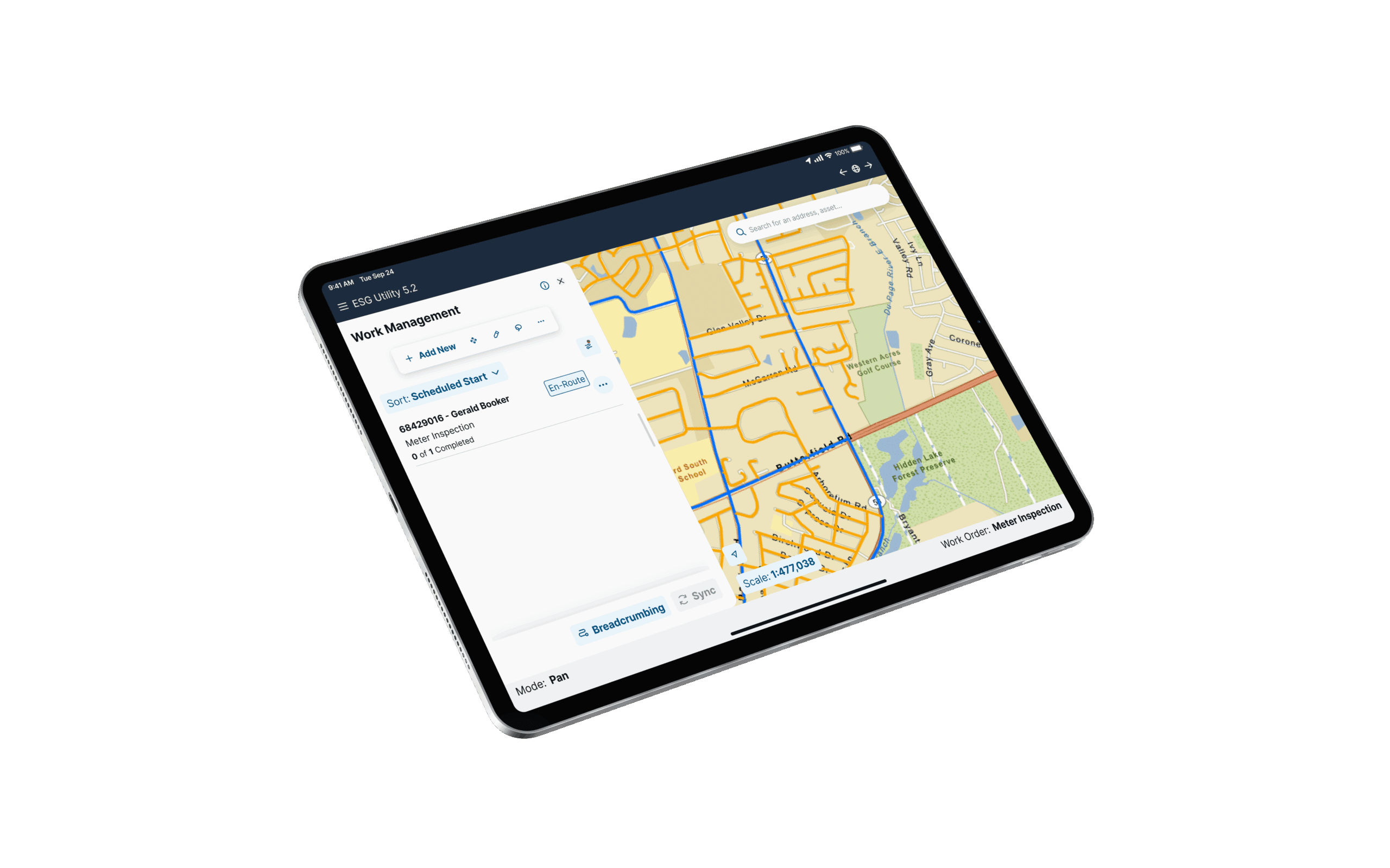
EpochField uses GPS to enable configurable geofencing. Crews can be alerted to issues like hazardous areas, restricted sites, a protective dog, etc. Users can also drop breadcrumbs along a crew’s route. By using GPS, EpochField helps keep its users safe and accountable.
Epoch Solutions Group helps utilities deliver safe, reliable and superior services through our innovative field solution, EpochField. We specialize in optimizing utility field operations, automating field activities and processes to improve safety, reliability, and response time. Learn how Epoch Solutions Group has helped utility companies across North America transform their field operations.