How to Use Geospatial Technology to Automate and Streamline Your Utility Field Operations

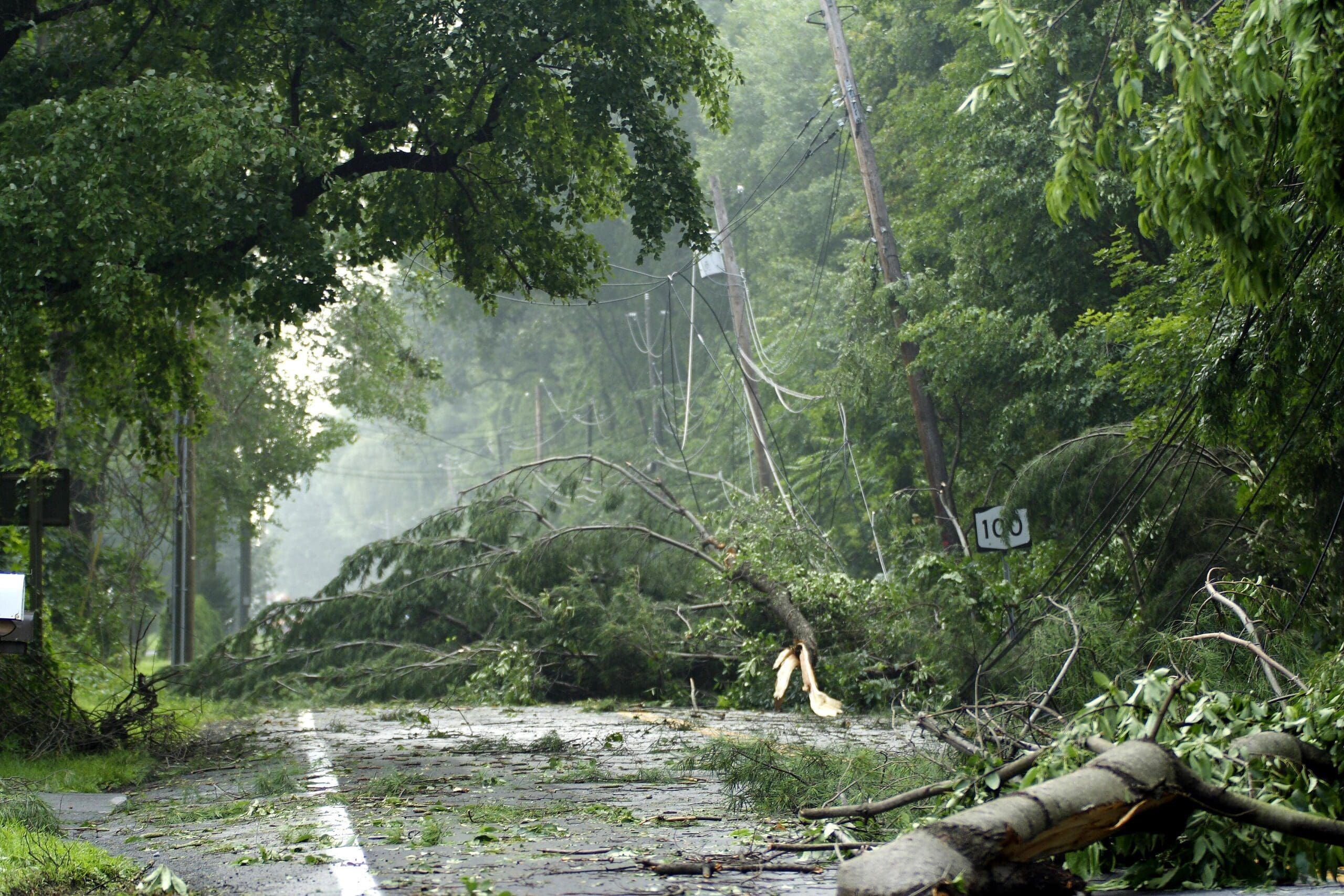
For many utility companies, data collection is largely a manual process, or one that involves a mix of technology and manual record keeping. Data must be collected, digitized, processed, and kept up to date when on-site infrastructure and assets change. Field workers are often also deployed to remote areas with no online connectivity, making it difficult to access and enter the data required to do their jobs. 

In-office personnel also face a variety of challenges around field workforce management – namely, the sheer volume of data being collected from a variety of sources. Data recorded in legacy, on-site systems is also challenging to disseminate to teams of field workers, particularly when it is siloed in disparate computer systems and applications and needed in real time. 

So, what is the solution? With the geographic reach and service demands of utility companies continuing to expand in both size and complexity, the need to digitally streamline operations is more pressing than ever. The right geospatial technology can help companies automate and streamline the management of their geospatial data. 

Key advantages of geospatial technologies include: 

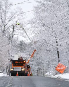
  • Integration of data into operational and business workflow processes to influence decisions on resource allocation and expediting the deployment and management of field crews. 
  • Ability to display physical assets digitally in interactive maps that allow utility personnel to drill down to pertinent details about the assets and their surrounding terrain. 
  • Fast, easy workflow creation and management, efficient work scheduling engines, and data synchronization modules for asset map data. 
  • Integration with enterprise GIS and business applications used by employees and other stakeholders, including Oracle, IBM Maximo, and SAP.

View the recording of our recent webinar, “Uncover Opportunities to Automate & Streamline Field Operations Through Geospatial Innovation”, to learn more about geospatial technologies, as well as the features to look for when selection the right solution for your company.

View the Webinar Recording

Schedule a Free Workforce Management Assessment

Digitizing Gas Utility Workforce Management Enhances Community Safety

Industry technology is quickly transforming, making it essential for natural gas utility companies to improve the efficiency and effectiveness of their operational workflows. One way to accomplish this is to automate and digitize the data collection process. By digitizing workforce management, natural gas companies eliminate manual touchpoints that can compromise not only the quality and accuracy of the data but also community safety.

Tracking and traceability automation solutions enhance safety measures by allowing natural gas companies to adhere to safety and environmental regulations that keep communities safe by preventing gas line-related disasters and that reduce the gas industry’s environmental footprint. These digital solutions are revolutionizing the natural gas industry, bringing deep, real-time visibility into the locations, conditions, and technical attributes of natural gas assets, information that can be easily accessed and utilized by mobile field workers who are tasked with installing, inspecting, and repairing equipment.

The ideal tracking and tracing automation can support workflow processes allowing field workers to have remote access to asset map data and be able to work more efficiently in the field. When field workers can visually represent asset data, it increases the effectiveness and accuracy of both small, individual crews and entire services territories. Below are a few important features you want to look for when selecting your workflow automation.

  • A web-based platform to serve as a point of integration enterprise-wide for administration personnel, supervisors, and dispatchers
  • A full-featured mobile application allowing workers to conduct installation, inspections, and other routine maintenance tasks with all the data and functionality at their fingertips – on their smartphone or computing device of choice
  • Forms that can be easily configured
  • Offline functionality and high-accuracy GNSS receiver integration for easy mobile access to satellite data
  • A scheduling and dispatch engine that leverages real-time insights to expedite and simplify mission-critical workforce deployments
  • Mobile workforce management features that allow managers back at the office to dynamically track the location of field crews and quickly divert them to new locations as needed
  • Work-order management functions for easy digital planning, tracking, and management of work orders
  • Enterprise level asset management tools to coordinate essential operational processes and enable deep, ongoing visibility into the condition of remote natural gas infrastructure.

Download our latest guide, “Automating Tracking and Traceability Processes: Minimizing Human Error for Better Field Outcomes” to discover how digital tracking and traceability tools can help you lay the foundation for a future defined by greater uptime, innovation, and better protection from the damaging effects of environmental factors.

Digitization in Mobile Workforce Management: Overcoming 5 Barriers in Field Operations

The pandemic added a level of urgency to digitization in utilities unlike anything the industry has ever seen. And yet, for many companies, the ongoing work towards digital transformation has been anything but smooth.

In this report, we cover some of the barriers we’ve seen firsthand as companies follow the path to streamlining and simplifying end-to-end mobile workforce management.

Read the guide to learn:

  • How digitization is reshaping field operations and bridging the gap between field and office workflows
  • The top 5 obstacles companies face when implementing technologies meant to promote digital ways of working
  • How to overcome these challenges with a phased, achievable roadmap to digitization

Download the White Paper

Increasing Readiness and Assessment Efficiency with a Sound Damage Assessment Solution

EpochField optimizes storm management, before and after a storm, by automating common damage assessment workflows.

Increasing Readiness and Assessment Efficiency with a Sound Damage Assessment Solution

Old Methods and Process

Historically, utilities have utilized manual methods and processes when approaching a damage assessment workflow. A common approach to a manual assessment typically goes as follows: the use of printed paper maps, assigning work tickets to a field worker, handwriting assessed damage data, and then manually updating back-office outage management systems (OMS) once the data has been delivered.

Increasing Readiness and Assessment Efficiency with a Sound Damage Assessment Solution

Open Loop Damage Assessment Process:

  1. Printing of maps.
  2. Assigning damage tickets and maps to field crew.
  3. Field crew collects and reports damage by hand, on printed maps.
  4. Driving back to the storm center with maps notating damage.
  5. Aggregating all the notations on each map to a) make sense of it, and b) determine a game plan for repair.
  6. Someone else manually entering the status of the damage ticket in the Outage Management System and creating a work ticket.
  7. Beginning the routing process for work tickets.

The open-loop damage assessment process is a lengthy process, inefficient, and prone to errors when compared to modern methods. Often, a damage assessment team can run into several problems such as difficulty interpreting handwritten notations, lack of accurate data collection, and the difficulties of printing and using paper maps.

Automating a Damage Assessment Workflow

Although automating damage assessment workflows is a process in itself, the long-term benefits are worth it. Even though a damage assessment workflow will change case by case, generally the automation approach starts with using mobile devices in the field to collect damage data, electronically synching that data with outage management systems, then planning a restoration plan based on that data.

“Utilities can increase restoration efficiency following a major storm by automating data collection, scheduling, and restoration planning with EpochField.

Where Does EpochField Fit In?

Damage Assessment starts in the back office with supervisors viewing outages on dashboards and crew locations on a spatial map in real-time with integrated GPS tracking. By using EpochField Administrator and EpochField Work Scheduler, a plan and assessment strategy is developed based on crew location and outage areas. Field crews utilizing EpochField Mobile on lightweight tablets receive work orders from the back office and note damage specifics on configurable forms. Progress is tracked in real-time with tools and dashboards, enabling utilities to prioritize restoration areas.

Sometimes, in areas such as with high hurricane or tornado activity, the damage is so severe field crews cannot determine where utility assets were located. With the tablet’s internal GPS and GIS information, field crews will know exactly what materials are needed to be replaced. EpochField will then build a list of materials required for restoration and sync that data to the OMS for warehouse personnel to load construction materials on trucks for the crews.

Utilities can quickly restore power using EpochField by taking advantage of timely damage assessment information. With EpochField, utilities can quickly gain a detailed picture of the damage, identify and prioritize damaged areas, and assist staff with a restoration plan based on accurate GIS data.

Schedule a demo today to learn more about how EpochField can transform your storm damage assessment and response processes.